Raja Ampat, Indonesia – Arnauld Brival from The Sea People shared an innovative coral monitoring initiative using geospatial technology to map reef health across the world’s most biodiverse marine ecosystem. Since 2016, the project has focused on ecological feasibility assessments and restoration planning using ESRI’s ArcGIS tools and modified Manta Tow surveys.
A New Take on Manta Tow Surveys
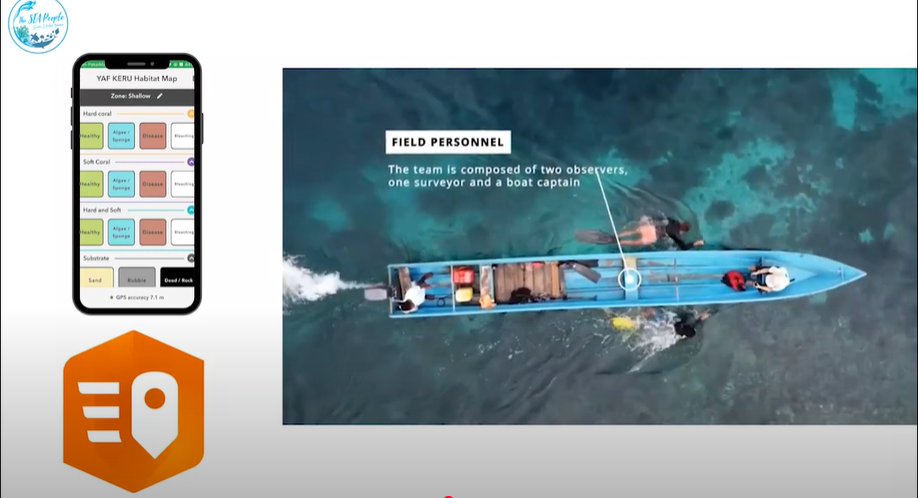
The Sea People adapted the traditional manta tow method into a four-person team operation: one steers the boat, one records observations onboard, and two snorkelers survey coral health and substrate conditions. By integrating their observations into a custom ArcGIS app, the team generated detailed coral health maps now available online (theseapeople.maps.arcgis.com).

Degradation Hotspots and Restoration Priorities
The mapping effort revealed that reefs near villages showed higher degradation levels, while remote areas had healthier coral cover. Interestingly, some shallow degraded zones were found to overlay healthy corals at deeper levels. The maps also helped distinguish between damage caused by human activity—such as blast fishing and mining—and natural disturbances like monsoon storms.
Challenges: From Dynamite to Deregulation
Raja Ampat faces major threats including destructive fishing practices, unsustainable mining, mass tourism, and climate change deregulation. One recurring issue is the ‘snowball effect’: damaged corals on steep slopes slide downward and crush healthy colonies below. These dynamics highlight the importance of stable substrate and site-specific restoration strategies.
Scaling Up: From 1,000 m² to 1 Million
Arnauld emphasized that global coral restoration efforts still fall short in scale. While most projects cover less than 1,000 m², degradation affects over 1 million m². To bridge this gap, rapid assessments are needed to identify reef condition, damage sources, and priority zones for intervention.

Outcomes and Impact
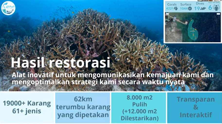
The Sea People’s restoration efforts have planted over 19,000 coral fragments from 61 species, mapped 62 km of reef, and restored 8,000 m² while protecting an additional 12,000 m². The program also boosts local livelihoods, engaging 1,500 residents from 9 villages and educating tens of thousands of visitors. The project’s impact spans ecological and socioeconomic domains—laying a foundation for informed, community-centered reef protection.
